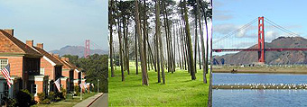
COURSE DIRECTIONS
(If this page does not appear in frames, please click here).
Choose a Presidio trail run for directions!
Monday Rx: Fall & Winter - Presidio/Marina Run
Monday Rx: Spring & Summer - Coastal Trail Run
Wednesday Rx: Route 1 - Mountain Lake
Wednesday Rx: Route 2 - Presidio Heights
Wednesday Rx: Route 3 - Infantry Run
Sunday Rx: Presidio Extreme
Detailed Map of the Presidio (341kb)
Monday Rx: Presidio/Marina
Run (~5.3 miles)
course map (250kb)
-Starting at the Palace of Fine Arts, proceed South on Lyon Street to the Presidio
Gate @ Lombard Street.
-Turn West on Lombard, into the Presidio.
-Continue on Lombard to Presidio Boulevard, then turn right, and onto Lincoln Boulevard.
-Follow Lincoln Boulevard for about 1.25 miles.
-At Chrissy Field Avenue, go down the hill, and onto Mason Street.
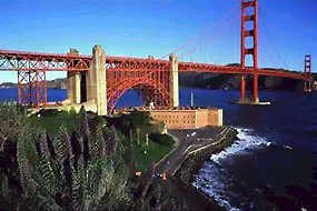
-At Mason Street, continue Westward towards the Golden Gate Bridge (quite a view, isnt
it?), about 300 meters.
-At the end of Mason Street, make a sharp right turn onto the coastal dirt trail, and
continue on the trail for about 200 meters, past the Farallones Marine Sanctuary Visitor
Center.
-Turn right, up a set of 3 steps, and cut across Chrissy Field, and back onto Mason
Street.
-Left on Mason, and continue towards the Palace of Fine Arts, in the distance on your
right.
-Short course: On Lyon Street, turn right and finish at Palace of Fine Arts.
-Long Course: At Lyon Street, Mason Street turns into Marina Boulevard.
-Continue along Marina Boulevard to Fillmore Street.
-Turn right at Fillmore.
-Turn right on Beach.
-Turn left on Baker.
-Turn right on Bay to finish at POFA.
Monday Rx: Coastal Trail Run (~4.9 miles)
course map (335kb)
-Starting at the Palace of Fine Arts, proceed South on Lyon Street to the Presidio
Gate @ Lombard Street.
-Turn West on Lombard, into the Presidio.
-Continue on Lombard to Presidio Boulevard, then turn right, and onto Lincoln Boulevard.
-Follow Lincoln Boulevard for about 1.25 miles.
-Go right down the hill at Patten Road.
-Right at McDowell Avenue for about 50 meters.
-Left at Cowles up to Lincoln Boulevard.
-Right at Lincoln, Continue to Long Avenue.
-Down Long Avenue to Marine Boulevard.
-Left at Marine Boulevard.
-Go up the STAIRS to the Coastal Trail.
-Follow Coastal Trail about 0.75 miles, under the Golden Gate Bridge and along the Bay
until you reach Merchant Road.
-Left at Merchant and down the hill, through the tunnel under the GG Bridge toll plaza.
-After the tunnel, make a right and cut through the parking lot, back onto Lincoln
Boulevard.
-Left at Lincoln, Continue to Chrissy Field Avenue.
-Left, down the hill at Chrissy Field Avenue.
-Right at Mason Boulevard.
-Follow Mason 1.5 miles towards POFA.
-Right at Baker Street.
-Finish at POFA (Lyon/Bay intersection)

Wednesday Rx
Wed: Route 1 - Mountain Lake (~5.06 miles)
course map (351kb)
-Starting at Presidio Gate,
go West on Lombard and head up Ruger Street.
-Ruger becomes Simonds Loop, Continue to Presidio Boulevard.
-Cross Presidio Blvd to Liggett Avenue.
-Left at Lover's Lane Trail, Continue up hill.
-Right at West Pacific Avenue.
-Continue on West Pacific for about 1.75 miles (past the golf course, all the way down to
and past Mountain Lake, under the Park Presidio overpass, and to the former Public Health
Service Hospital).
-Continue north on Battery Caulfield Road--great hill here!
-At Washington Boulevard, continue going straight (across the lawn) and onto the Anza
National Historic Trail.
-Stay on trail for about 0.6 miles.
-Right at Kobbe Avenue, continue on Kobbe to Park Blvd.
-At Park Boulevard, cross the street onto the dirt trail.
-Right at Lincoln Boulevard.
-Follow Lincoln back to the finish at the Presidio Gate.
back to top
Wed: Route 2 - Presidio Heights (~4.1 miles)
course map (256kb)
-Starting at Presidio Gate,
proceed South on Lyon Street to the Lyon Stairs.
-Run Up stairs. At top, continue to Jackson Street.
-Left on Jackson, and continue to Steiner.
-Right on Steiner.
-Right on Clay Street.
-Continue on Clay towards Temple Emmanuel on Arguello Street.
-Right on Arguello.
-Right on Jackson Street.
-Left on Presidio Street.
-Go through the Presidio Gate and down Lover's Lane Trail.
-Right on Liggett.
-Left on Presidio Boulevard.
-At Lombard, turn right to the finish at the Presidio Gate.
Wed: Route 3 - Infantry Run
course map (321kb)
-Starting at Presidio Gate,
go West on Lombard.
-Continue
on Lombard to Presidio Boulevard.
-From Presidio Boulevard, merge onto Lincoln Boulevard.
-Turn right at Halleck Street, and head down to Mason Street.
-Left on Mason.
-Continue on Mason Street, towards GG Bridge, until you reach the end of Mason.
-At the end of Mason Street, make a sharp right turn onto the coastal dirt trail, and
continue on the trail for about 200 meters, past the Farallones Marine Sanctuary Visitor
Center.
-Turn right, up a set of 3 steps, and cut across Chrissy Field, and back onto Mason
Street.
-Right at Mason to Chrissy Field Avenue.
-Left at Chrissy Field Avenue, up the hill and onto Lincoln Boulevard.
-Continue on Lincoln until you reach Montgomery.
-Right on Montgomery.
-Left at Moraga.
-Left at Funston.
-Right on Lincoln
-Right on Presidio Boulevard.
-Turn left at Lover's Lane trail.
-Continue up the Lover's Lane hill until you see the end of Clarke St., which is on your right and parallels
Lovers Lane.
-Turn around, and come back down Clarke Street onto Liggett Avenue.
-Right on Liggett.
-Left on Presidio Boulevard.
-Right on Lombard, and continue to finish at the Presidio Gate.
Sunday Rx: Presidio Extreme (~5.5 miles)
Our favorite Presidio trail run !
course map (324kb)
-Starting at Sports
Basement, cut through the parking lot to Lincoln Boulevard.
-Cross Lincoln and onto Montgomery Street.
-Left at Moraga Avenue.
-Right at Funston Avenue. Head up the Ecology Trail (great hill and views!), past
Inspiration Point, and to the Arguello Gate.
-Continue on West Pacific for about 1 mile (past the golf course, all the way down to and
past Mountain Lake, under the Park Presidio overpass, and to the former Public Health
Service Hospital).
-After passing the hospital, make a left onto the sandy trail of the "Lobos
Dunes." Trail ends at Lincoln Boulevard.
-Cross Lincoln onto Bowley Street.
-Right at Bowley.
-Left at Gibson Road towards Baker Beach.
-Veer off to the right and cut through the beach parking lot.
-At end of parking lot, pass through gate, and past old WWII bunkers and canons.
-Head up along the Coastal Trail--another excellent hill here with spectacular views along
the cliffs. Follow Coastal Trail for about 1.5 miles.
-Coastal Trail brings you underneath the Golden Gate Bridge. Follow the bike path
near the Bridge to Lincoln Boulevard.
-Left at Lincoln.
-Hang left, down the hill at Chrissy Field Avenue, then veer left to Mason Street.
-Look for the Sports Basement sign in the distance and sprint!